
Foreign transit systems are wonderful until you’re standing in a Tokyo station the size of a small city, staring at a map that might as well be abstract art, while your train leaves in 90 seconds. The right apps turn that panic into a calm “oh, platform 4, two stops.” If you’re asking what are the best apps for navigating public transit abroad, here’s the toolkit: the global essentials everyone needs, the regional champions that beat Google in specific countries, and the offline strategies for when data fails you.
Download and set up these apps before you leave — on hotel wifi, not while panicking at the station.
What Are the Best Apps for Navigating Public Transit Abroad? The Global Essentials
- Google Maps (free): the baseline — transit directions in 10,000+ cities across 100+ countries, with real-time departures, platform numbers, and service alerts. Download offline maps for your destinations before departure. Its transit layer is genuinely excellent in most of Europe, East Asia, and the Americas. Weak spots: parts of Africa, rural areas, some Southeast Asian cities.
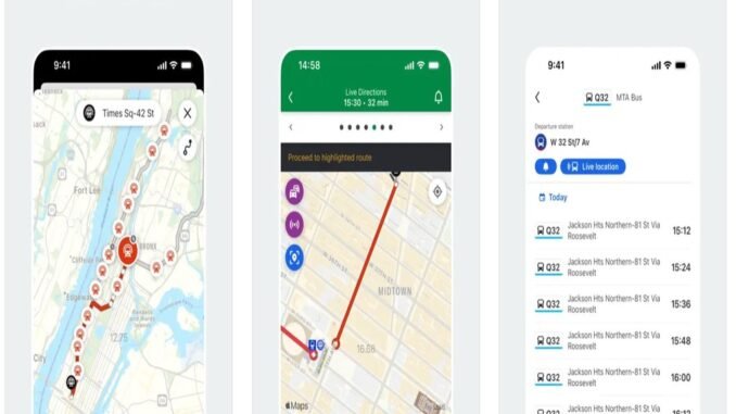
- Citymapper (free): the transit nerd’s choice — covers 100+ major cities with obsessive detail: which train car to board for the fastest exit, step-by-step multimodal routes (walk + bus + train + scooter), real-time disruption rerouting, and a brilliant “get me home” button. Where it’s supported (London, Paris, NYC, Tokyo, etc.), it beats Google for transit specifically. Check coverage for your destinations — it’s city-based, not universal.
- Moovit (free): widest global coverage of the transit-specific apps — 3,500+ cities in 112 countries. Strong in places Google under-serves (Israel, parts of Latin America, Eastern Europe). Real-time arrivals and service alerts. The interface is busier than Citymapper, but the coverage is unmatched.
Regional Champions (Better Than Global Apps Locally)
- Japan: Japan Travel by NAVITIME + Google Maps. NAVITIME handles Japan’s famously complex fare system (JR vs. private lines, which IC card works where) better than anything. For bullet trains, the SmartEX app books Shinkansen tickets directly. Hyperdia’s old crown has passed, but it still works for timetable purists.
- UK: Trainline (trains) + Citymapper (London). Trainline books all UK rail with live pricing and mobile tickets — essential since UK walk-up fares are punishing. For London’s Tube/buses, Citymapper or TfL Oyster/TfL Go. Contactless payment caps daily charges automatically — just tap in/out with the same card.
- Europe: Trainline (multi-country rail) + Omio. Trainline covers 45+ countries’ rail; Omio compares trains, buses, and flights on one screen. For real-time departures, each country’s rail app (DB Navigator for Germany — superb; SNCF Connect for France; Trenitalia for Italy) beats aggregators.
- China: Amap (Gaode) + MetroMan. Google doesn’t work in China — download Amap (English version available) and MetroMan for subway maps. You’ll also need a VPN set up before arrival for everything else.
- Korea: Naver Map + KakaoMetro. Google Maps is crippled in Korea by local mapping laws — Naver Map is the essential download, KakaoMetro for subways.
- Southeast Asia: Grab. Uber’s successor across the region — ride-hailing, food delivery, and increasingly transit info. Essential in Thailand, Vietnam, Malaysia, Singapore, Philippines.
Tickets and Payment Apps
Navigation is half the battle; paying is the other:
- Digital transit cards: add Suica/Pasmo (Japan), Oyster (London), or Navigo (Paris) to your phone wallet before departure where supported. Tapping your phone beats ticket machines in foreign languages every time.
- Contactless bank cards: London, Sydney, and many European systems accept tap-to-pay directly with daily fare capping. One less app, one less card.
- Official city apps: for passes and tickets — RATP (Paris), BVG (Berlin), MTA (NYC’s OMNY). Buy day/week passes in-app and skip the machines.
When Data Fails: The Offline Strategy
- Download offline Google Maps for every city (search city → download). Transit directions partially work offline; full routing needs data.
- Screenshot your route before going underground — stations kill signal worldwide.
- Carry the hotel’s business card (physical) — show any taxi driver or helpful local. Low-tech, unfailingly effective.
- Learn the system’s logic: 10 minutes studying the metro map at the hotel (colored lines, terminus stations as direction indicators) beats app-dependence. In most systems, you navigate by line color + direction of the end station.
- eSIM or local SIM: an Airalo eSIM ($5–$20 for a week of data in most countries) means you’re never truly offline. The connectivity checklist principle applies everywhere — sort data before you land.
Transit confidence also pairs with transit safety habits — the apps get you on the right train; the habits keep your stuff on it with you.
The Station Survival Guide (When the App Isn’t Enough)
Apps fail — dead batteries, no signal, confusing stations. The analog skills that save you: Learn the line-color logic: in virtually every metro system, you navigate by line color plus the direction of the terminus station. “Take the red line toward Downtown” works in Tokyo, Paris, and Mexico City alike. Memorize your line’s color and your direction’s terminus before descending. Follow the exit signs early: giant stations (Shinjuku, Châtelet, Grand Central) have 10+ exits — check which exit you need before the train arrives, not after surfacing six blocks wrong.
The info booth is underrated: station staff deal with lost tourists all day and will literally draw your route on a map. A smile and “excuse me” outperform 10 minutes of app-fumbling. Paper backup: grab the free metro map at the airport or hotel — it works with zero battery and gives you the system overview no phone screen can. When truly lost: surface, find a café with wifi, regroup. Nobody ever stayed lost in a city with cafés. For official transit information, bookmark the local operator — Transport for London’s site is the gold standard of clear transit guidance, and most major cities have an equivalent. Apps are the primary tool; station sense is the backup that never runs out of battery.
The Bottom Line
Navigate foreign transit with: Google Maps (offline maps downloaded) + Citymapper or Moovit for transit depth, the regional champion for your destination (NAVITIME for Japan, Trainline for Europe/UK, Naver for Korea), digital transit cards in your phone wallet, and an eSIM so you’re never offline. Set it all up on home wifi before departure — future you, gliding through Shinjuku Station like a local, says thanks.
Leave a Reply