
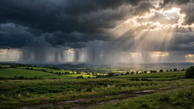
Is now a good time to start understanding how rain forms — or should you wait? This might be the easiest question in this entire series to answer: start now, because rain is the most beginner-friendly phenomenon in all of atmospheric science. No advanced math, no million-dollar equipment — just water, air, and temperature doing an elegant dance you’ve watched your whole life without noticing the choreography. In the next fifteen minutes, you’ll understand the water cycle’s engine room: how invisible vapor becomes a cloud, how a cloud becomes rain, and why some clouds rain and others just drift by.
The Setup: Why the Air Is Full of Invisible Water
Before rain, there is evaporation. Sunlight heats oceans, lakes, rivers, soil, and even leaves (plants release water through transpiration), and water molecules escape as invisible vapor. Warm air can hold far more vapor than cold air — roughly doubling its capacity every 11°C (20°F) of warming. This single fact drives nearly everything about rain.
Here’s the key beginner insight: clouds and rain are what happen when air cools down and can’t hold its water anymore. Every rain story is a cooling story. The only question is what did the cooling — and the answer gives us the three main types of rain.
Act One: Rising Air Cools and Clouds Are Born
Air cools as it rises because atmospheric pressure drops with altitude — expanding air cools, the same physics that makes a spray can cold when you use it. When rising air cools to its dew point (the temperature where it’s saturated), vapor condenses into microscopic droplets around tiny particles called condensation nuclei: dust, salt, pollen, even pollution. A cloud is not vapor — it’s a visible swarm of billions of these droplets, each about 100 times smaller than a raindrop.
This is why the sky fills with puffy cumulus clouds on a warm afternoon: the sun heats the ground, warm bubbles of air rise (thermals), and each bubble sprouts a cloud at the altitude where it cools to saturation. The flat bottoms of cumulus clouds mark that exact altitude — a visible line where physics changed state. Once you know this, you’ll never look at a summer sky the same way.
Act Two: Droplets Grow Up and Fall Down
Cloud droplets are too small to fall — they drift. To become rain, they must grow roughly a million times in volume. Two mechanisms do this, and which one operates depends on temperature:
The warm-rain process: collision and coalescence
In warm clouds (entirely above freezing), larger droplets fall slightly faster than smaller ones, sweeping them up like a snowball rolling downhill — collision-coalescence. In tropical clouds with strong updrafts, droplets can cycle upward repeatedly, growing with each lap until they’re too heavy for the updraft. This is why tropical downpours are so intense: the updrafts are powerful droplet factories.
The cold-rain process: the Bergeron miracle
In mid-latitude clouds that extend above the freezing level, something subtler happens. Ice crystals and supercooled water droplets coexist, and physics favors the ice: water evaporates from the droplets and deposits onto the crystals (the Bergeron process, named for Swedish meteorologist Tor Bergeron). The crystals grow heavy, fall, melt into rain on the way down — or reach the ground as snow if it’s cold enough. Most rain in the United States, even summer rain, started life as ice crystals miles overhead.
The Three Ways Air Gets Lifted: Types of Rain
Remember: rain needs rising, cooling air. The three lifting mechanisms produce the three classic rain types:
Convective rain — heated ground lifts air in bubbles. Think afternoon thunderstorms: violent, brief, local. The towering cumulonimbus is the signature.
Orographic rain — mountains force air upward. Air climbing the Rockies or Cascades cools, dumps rain on the windward side, and descends warm and dry on the lee side — creating rain shadows like eastern Washington’s deserts. This is why Seattle is famously drizzly (lifted Pacific air) while just east of the Cascades it’s arid.
Frontal (cyclonic) rain — where warm and cold air masses meet, the lighter warm air is forced up over the denser cold air along a front. This produces the broad, steady, day-long rains of mid-latitude storm systems — the classic “rainy weekend” soaker.
The NOAA Jetstream water cycle explainer illustrates all three with diagrams aimed at students and curious adults.
Why Some Clouds Rain and Others Don’t
Every beginner asks this watching the sky. The answer is a checklist: the cloud must be deep enough (droplets need a long fall path to grow), the air must have enough moisture, and there must be sufficient nuclei — though nuclei are rarely the limiting factor. Thin, shallow clouds simply don’t give droplets the runway to reach raindrop size before evaporating. Those wispy high cirrus clouds? Ice crystals, too high and dry to ever reach you.
There’s also a delightful subtlety: very clean air can suppress rain. After major volcanic eruptions inject particles into the stratosphere, the extra nuclei create so many tiny droplets that none grow large — a reminder that “more ingredients” doesn’t always mean “more rain.” Cloud seeding — the controversial practice of adding nuclei to coax rain — works on exactly this physics, with modest, debated effectiveness documented by the UCAR Center for Science Education.
Reading the Sky: Your New Party Trick
Understanding rain formation pays off immediately in everyday life. Dark, flat-bottomed clouds with tall vertical growth? Rain likely within the hour. A thin veil of cirrus thickening through the day? A warm front approaching — steady rain in 24–48 hours. A sudden drop in temperature with gusty wind? A cold front’s convective line, brief but intense.
This is practical knowledge, too. Gardeners time watering around coming rain; homeowners know that understanding how to winterize a home before cold weather starts with understanding where the water goes. And on the days the rain does come, you’ll have the perfect excuse for the best movies to watch on a rainy weekend — now with full appreciation of the atmospheric physics outside your window.
Conclusion: The Sky Was the Textbook All Along
So is now a good time to start understanding how rain forms? There’s never been a worse reason to wait and never a better moment to start — the next cloudy afternoon is your laboratory. The whole story fits in one sentence: air rises, cools, can’t hold its water, droplets grow, gravity wins. Everything else — Bergeron processes, orographic lifting, frontal systems — is that sentence wearing different weather. Step outside, look up, and read the sky like the physics textbook it always was.
Frequently Asked Questions
How does rain form in simple terms?
Warm, moist air rises and cools. Cooling air can’t hold as much water vapor, so vapor condenses into tiny cloud droplets. Droplets collide and merge (or grow on ice crystals in cold clouds) until they’re heavy enough to fall as rain.
Why do some clouds produce rain and others don’t?
Rain needs deep clouds with enough moisture and a long enough droplet-growth path. Shallow or high, dry clouds don’t give droplets time to grow to raindrop size before evaporating.
What are the three types of rain?
Convective (heated ground lifts air — thunderstorms), orographic (mountains force air up — e.g., Pacific Northwest drizzle), and frontal (warm air riding up over cold air along weather fronts — broad steady rain).
Does rain start as ice?
Often, yes. In mid-latitude clouds extending above the freezing level, precipitation begins as ice crystals that grow via the Bergeron process, then melt into rain as they fall through warmer air below. Much U.S. summer rain began as ice miles overhead.
Can humans make it rain?
Cloud seeding (adding particles like silver iodide to encourage droplet formation) can modestly enhance precipitation from suitable clouds, but it can’t create rain from clear skies, and its effectiveness remains scientifically debated.
Leave a Reply